Buffalo River Map
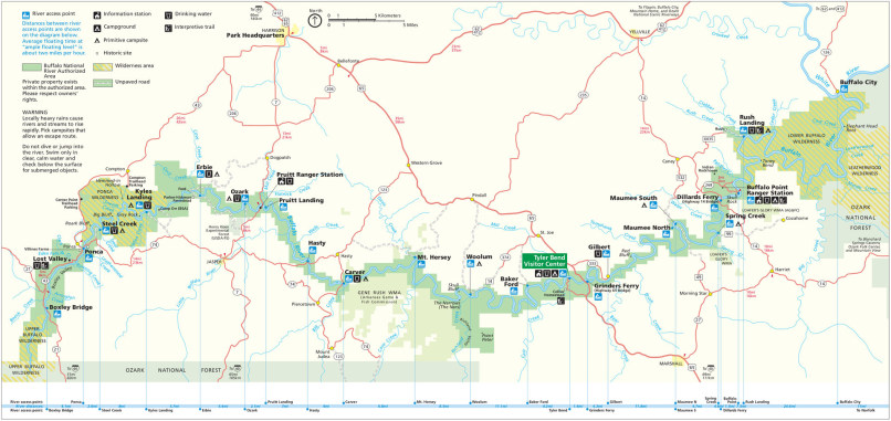
The best map guide for planning your visit to Buffalo National River. The river flows from west (left side) to east. It is generally floatable on the west (beginning) section only during the spring and fall when it's rained substantially in the previous days or weeks. The middle section is floatable somewhat more often, and the lower, east section is usually floatable year round. More great Hi-Res maps are available here for free! Check CURRENT WATER CONDITIONS HERE.